PlotProjects is proud to announce that the software stack for our new POI API is for sale. As one of the leading geofencing providers, we developed the POI API as an addition to our geofencing SDK, to offer more accessible and reliable POI data than OpenStreetMap.

The POI API is now for sale to companies looking to use POI datasets, or who are interested in commercialising the product and offering it as a software-as-a-service (SaaS) solution. Thomas Joosten, CEO of PlotProjects said:
We developed our own POI offering because OpenStreetMap isn’t the ideal solution in all scenarios where businesses need point of interest data. Our aim was to provide a solution that excels in the areas where OpenStreetMap falters, for example, ease of data access, up-to-date POIs, and comprehensive search functionality, with flexibility and customisable search parameters.
Our POI API offers the entire process out-of-the-box, so you can easily access reliable and trustworthy data that’s ready to use, is scalable, and is enriched with more external sources. Our data is constantly refreshed, so you’ll always get the most recent data. And our API integrates easily with your existing software.
We began development for the new product in 2022, and an operational Alpha version is now working and being tested on Poi.plotprojects.com. Those who are interested in buying the software code, or who want to discuss opportunities to co-develop, should contact PlotProjects today.
Tell me more about POIs
POI datasets have multiple applications across many different industries. They can help businesses deliver location-based services, gain location intelligence or make better data driven decisions. For example, POIs can be used in mobile apps to send notifications when a user is at a point of interest such as a supermarket, a shop, a restaurant, ATM or other place. They can be used to verify addresses for fast deliveries and route optimisation. POIs can also be used in address autocomplete, to help users complete their address quickly and accurately in online forms and checkouts – this also helps to eliminate bad data, increase conversions, and prevent costly delivery mistakes.
Who needs a POI API?
Any company that uses POIs and needs to update their datasets regularly can use the PlotProjects POI-API as a basis to import and use POIs from OpenStreetMap. The architecture is set up, there is a working MVP, and the software architecture is built for scale. Apps like Shopfully, Marktguru.de, and many more can use it, as well as providers of POIs, and companies building in the space of Geofencing, Geotargeting, POIs sales can use the product to build a business around it. To build this piece of software in-house, an investment of €75,000 euro to €150,000 euro would be needed.
You can find out more about the many uses of POI data in this handy guide.
Why a points of interest API?
PlotProjects initially developed the idea and product due to clients buying POI datasets from different sources like Google Maps, Safegraph and more, to use in our Geofencing SDK. For example, a mobile app offering discounts in supermarkets, buys POI datasets of supermarkets. The app can then send notifications to users when they are close to a supermarket. However, such POI datasets are typically very expensive. A good article on typical POI pricing can be read here.
While it’s possible to obtain POIs for free from OpenStreetMap.org, the process is tedious and time consuming. Additionally, the OpenStreetMap environment and data structures are quite specific, requiring programming and data processing to actually be able to extract the POIs in usable way. Additionally, the servers of OpenStreetMap.org are not stable or reliable as they are publicly funded, and rely on data gathered from volunteers.
As such, we recognised the need for a central service which makes OpenStreetMap POI data available quickly and easily. Our POI API is the perfect alternative to OpenStreetMap, helping customers bypass the limitations of OpenStreetmap and obtain POIs at a lower price and without the hassle of extracting the data themselves or having to buy POIs from other pricey providers. With our product, companies don’t have to develop the interface or go through the process of obtaining up-to-date POIs from OpenStreetMap.org.
What does the Plot API offer?
The PlotProjects POI-API offers users access to the POIs in a stable and vast database. With the POI-API, you can access a wealth of geographic information to improve location-based services and applications.
The API can be used for:
- Obtaining up-to-date Points of Interest in a manageable list
- Accurate geocoding and reverse geocoding
- Comprehensive search functionality for places, addresses, and points of interest
- Flexible and customizable search parameters
- Easy integration with existing applications and systems
Tell me more about its features?
The PlotProjects POI-API mainly offers ‘Places Search’ or ‘Address Search’. From these two features a couple of sub features are also offered.
The ‘Places Search’ feature allows you to search for places based on name, category, or location. One can use the POI-API to find places such as restaurants, parks, shops, hotels, and many more. Search results can be filtered based on category, distance, or relevance.
The ‘Address Search’ feature allows users to search for addresses based on name and location. One can use the POI-API to find addresses such as street names, building numbers, and more. Filters can be made on search results based on proximity, relevance, or other criteria.
Place Search and Address Search capabilities
- Geocoding and Reverse Geocoding: You can use our API to convert between addresses and geographic coordinates (latitude and longitude) or vice versa.
- Autocomplete: Our API provides an autocomplete feature that suggests the most relevant place or address as you type, making it faster and easier for users to find what they’re looking for.
- Multiple Languages: Our API supports multiple languages, allowing you to search for places and addresses using different languages and character sets.
- Customization: Our API allows you to customize your search queries and filter parameters to suit your specific needs.
- Accuracy: Our API leverages the accuracy of OpenStreetMap data to provide precise and reliable search results.
What stage is product development at?
To build the POI-API, 2 full stack engineers have invested roughly 1500 hours to build a first working version that can be tested. The POI-API is now usable in an alpha version where you can test it.
How does the POI software code work?
The code works through the download of all the OpenStreetMap data on POI’s in a PBF file. The import job puts the data in a POI database by Postgres where the POIs and data structure are in an easy to read format. The API gives access to the database. The POI request tracker manages the data calls for POIs in the different features (eg. autocomplete request or a geocoding request). The below picture shows the overview:

What is the tech stack?
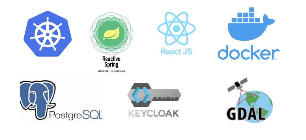
The tech stack is based on PostgresQL, Reactive Spring, Keycloak, GDAL, Docker, Jacket JS.

What are limitations with the POI-API?
- For now it can only be deployed in Google cloud platform, some work is required to use other cloud providers.
- The categories are hard coded in the Plot osm API, less than one day of work is required to improve that.
- No update at this stage, the job will run every Saturday and re-import all the data.
How much does the software cost?
The development of the software has cost PlotProjects roughly 1500 hours which is at an internal rate worth €75,000 euro. However, if it had been built externally it would have likely cost around €150.000 euro. We are willing to offer it in a way that companies can use it as an investment, therefore it can range from an upfront cash investment and a share in costs, or as a profit sharing deal.
Interested in buying the Plot POI API?
If you’re interested in buying the POI API, or you want to discuss opportunities to co-develop the product to offer it in the market, please contact PlotProjects.com, or Thomas Joosten at thomas.joosten@plotprojects.com, mobile: +31626062214
